|
|
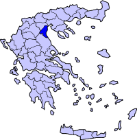
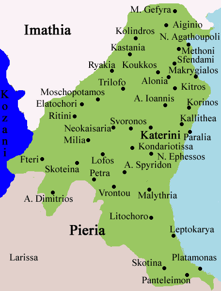
Methoni is a municipality of the Pieria prefecture. The true population of the municipality was 3.946 in 2001 divided in the districts
Nea Agathoupolis Nea Agathoupolis , a seaside settlement, was founded 1929 by refuges from Agathoupoli in East Thrace. Google Earth The ancient settlement of Methoni located at the interface between the Thessaloniki plain, the hilly terrain of Pieria Range and the shoreline of Thermaikos Gulf, has gone through numerous wartime situations over the past centuries. Methoni has been well known as an important harbour during the Greek Times closely affiliated with the Athenian Alliance. According to historical manuscripts the urban settlement was distanced from the harbour. However, there exist no historical references about neither the distance nor the potential locations of the harbour. Identification of the precise location of the Methoni port holds great significance from a geomorphological point of view, but above all represents a major archaeological concern. The port infrastructures appear to have been disconnected from the rest of the city: several decrees (notably in 430 and 423 BC) provide us with information on the matter (Queyrel, 2003). These infrastructures had been seized by the powerful city of Athens, in order to leave Methoni a degree of commercial autonomy with regards the Kingdom of Macedonia which was in full development at the time. One of these decrees, dated 430 BC, mentions that "the Methoneans must enjoy unrestricted rights to use the sea and [the Macedonians] must allow them, as before, to import goods on their territory". We also know that in 359 BC, Argeas, former enemy of Amyntas (father of Philippe II), or according to certain historians (Diodorus, XVI, 3, 5.) one of his sons, had just obtained a fleet of 3,000 hoplites from the Athenians: the troops disembarked and then set up in Methoni. No more references to the city are to be found in the texts after the seizure, then destruction, of the city by Philippe II's armies during the summer of 354 BC. There are signs of occupation during the Imperial period but there is no evidence of a continuous presence in the sector after the IVth Century BC (Papazoglou, 1988). Research efforts aiming to locate antique Methoni were undertaken from the XIXth Century, first by the famous English explorer W.M. Leake (Leake, 1967) who had travelled Macedonia at length and then by Léon Heuzey (Heuzey, 1876), who thought he had found the port of former Methoni, "marked by a small creek forming the shore not far from the mouths of Haliacmon" (Heuzey, 1876). Their respective research remained imprecise and no definite occupation site was ever identified. Their research was more focussed on the quest for the royal tomb of Philippe II and the Necropolis of the Temenid and Macedonian kings: Aigai, identified in the 1980s with the site of modern Vergina. In the middle of the XXth Century, Hammond used the descriptions of Strabo (Strabon, VII, fragments 20 and 22), positioning the city of Methoni at 70 stades (14 km) from Aloros (famous for being the original city of Ptolemy) and at 40 stades (8 km) from Pydna (Hammond, 1976), to produce the hypothesis whereby Methoni must have been located nearby the current eponymous city. Later, during the 1980s, two occupation sites were confirmed : the first, dating from the Archaic and Classical periods (Site A), was identified using archaeological material that had been found and then analysed. The second site, located slightly further north, dates from the Imperial period (site B) and presents a smaller spatial extension than the first (Hatzopoulos et al., 1990); nevertheless, no hypotheses concerning the location of port infrastructures were formulated, or even suggested. See also
 |
|
|||||||||||||||||||||||


|
|