|
|
|
||
| Area: |
97.93 km² |
||
| Population: (2001) | 13270 | ||
| Communes: | 12 | ||
| Elevation: -lowest: -centre: -highest: |
sea level 40 m about 1,000 m |
||
| Postal code: | 265 | ||
| Area/distance code: | 11-30-2610-9 (030-2610-9) |
||
| Municipal code: | 0719 | ||
| Car designation: | AX |
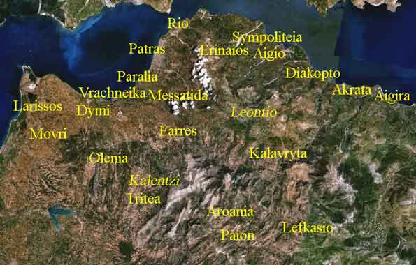
Agriculture and farmland used to dominate Rion until Patras' luxurious houses, a hospital and a university, reached the area in the 1970s or the 1980s, which only half of the community has farmlands in this day and continuing shrinking.
Rion is covered with sandy beaches in the west with a scenic local beach road lengthening for about 6 km. In the middle, a fortress, and a harbor located northwest of downtown. The harbor offers ferry service to Antirrion which, for the past 50 years, has enabled traffic to flow between the Peloponnese and Western Mainland Greece. The traffic through the ferries is quite heavy, including a lot of trucks. The ferries already been replaced by the Rio-Antirio Bridge. Not far from the port, a small oil refinery situated 800 m north and carries little production. Oil trucks are not allowed on the bridge and the ferry service is both regular and an economic alternative to the bridge.
Rio Beach includes Camping Rio Beach is its campground founded west of the centre. Its distances from Alissos is about 20 to 25 km.
The University of Patras is in its east and is bounded by a river in the south and southeast and a hospital is founded there, and a toll.
Hills and a mountain can be seen over the community's northeastern boundary.
Farmlands dominate the east and the west and used to dominate the southeastern part. Pastures and groves are common in the area. White Muscats are grown in this area and in Patras and wineries are also one of the main production of the local agriculture.
The municipality's population is about 10,000 and includes other communities including Aktaio (Actium), Kastritsi, Aghios Vasslils, and Psathopyrgos in the north. The community and the municipality is bounded in the south with a river.